Coastal storm may favor Ocean City snow and wind while Baltimore sits on the edge
A new coastal storm is taking shape after Maryland’s recent snow-and-ice event
Forecast models late Wednesday indicate another winter system may organize off the Mid-Atlantic coast this weekend, with a higher likelihood of accumulating snow and near-blizzard conditions at the beaches than in Baltimore. The expected setup places the Baltimore metro area near the storm’s northwestern edge, where small shifts in track can sharply change snowfall outcomes.
The potential weekend storm follows a high-impact winter event that brought heavy snow, sleet and freezing rain to large parts of Maryland. Subfreezing temperatures have persisted, increasing the risk that any new precipitation—especially on untreated roads, sidewalks and bridges—could quickly create slick travel conditions.
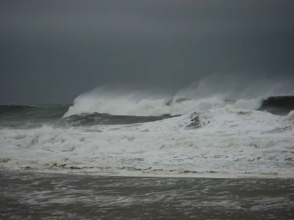
Why Ocean City could see more snow than Baltimore
Meteorologists expect the developing low-pressure system to deepen rapidly offshore. A track farther east typically limits heavy snow inland but can enhance snowfall along the immediate coast when cold air is entrenched. That combination can also produce strong onshore winds, blowing snow, and sharply reduced visibility—factors that may become the dominant hazards for Ocean City and the barrier islands.
Blizzard criteria hinge on wind and visibility rather than total snowfall. Even modest accumulation can produce near-whiteout conditions if gusts are frequent and visibility falls to a quarter mile or less for several hours. Forecast guidance has highlighted wind gust potential near or above the threshold commonly associated with blizzard conditions along the beaches, while Baltimore’s wind and snow potential depend more on whether the storm shifts west.
What current probabilities suggest for the region
Ensemble modeling—multiple simulations used to capture forecast uncertainty—has shown a high probability of at least light snow for Ocean City, with meaningful chances for several inches if the storm’s deformation band brushes the coast. For Baltimore, the same guidance has suggested a lower, but non-zero, chance of measurable snow, with odds dropping as accumulation thresholds increase.
Forecasters caution that at the five-to-seven-day range, models are better at flagging storm development than pinning down the exact track. Confidence typically improves in the three-to-four-day window, when smaller differences in storm position become clearer.
Key impacts residents should watch for
Travel: Coastal roads can become hazardous from snow, blowing snow, and potential icing. Inland, a small westward shift could raise snow totals and affect the I-95 corridor.
Wind: Strong gusts near the coast can reduce visibility, create drifting, and increase the risk of scattered power issues if combined with ice.
Cold: Prolonged subfreezing temperatures can turn even light precipitation into persistent ice and slow melting where snowpack remains.
Forecast confidence will hinge on the storm’s track: closer to the coast increases Baltimore’s snow potential; farther offshore concentrates impacts at the beaches.
Updates are expected as new model runs arrive and as winter weather watches or warnings are adjusted for specific counties.